Faculty details

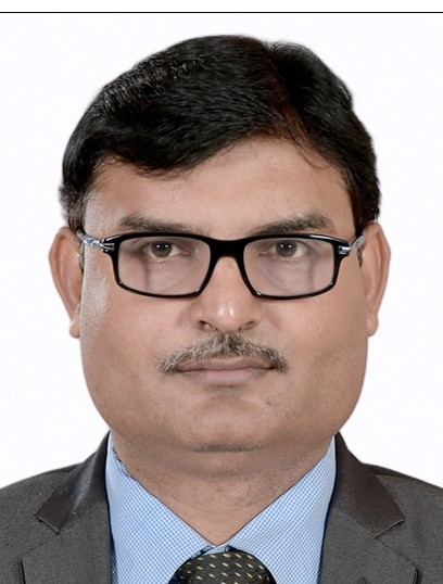
Prof.Dheeraj Kumar

Designation: Professor (HAG)

Department: Mining Engineering

Email: dheeraj[at]iitism[dot]ac[dot]in

Contact Number:

Office Number: +91-326-223-5486

Personal Page: Click Here

About Me: Prof. Dheeraj Kumar is a Professor (HAG) at the Department of Mining Engineering, IIT (ISM) Dhanbad, and holds administrative positions as Dy. Director of IIT (ISM) Dhanbad and Directors of TEXMiN and ACIC (the Mining Technology Innovation Hub of DST & the Community Innovation Hub of NITI Aayog). Prof. Kumar did his M.Tech. from IIT (ISM) Dhanbad and PhD from the Indian Institute of Technology (IIT), Kharagpur. He has 21 years of experience in Academic, Research, Outreach activities, and Administration in various positions, including Dean (Innovation), Dean (International Relations & Alumni Affairs), Assoc. Dean (Infrastructure), and academic positions. His areas of expertise include Mine Digitization & Mining 4.0 and Geospatial Technologies. Prof. Kumar has guided 20+ PhD Scholars and 50+ M. Tech students on Digitization, Automation, Remote Sensing, and GIS. He has organized several Professional Development Programmes (PDP) from one week to 14 weeks and trained 700+ mining professionals in Mine Digitization, Monitoring, and Digitalization. Prof. Kumar has developed and commercialized indigenous mining technologies for safe, intelligent, and sustainable mines. Prof. Kumar has mentored several startups and innovators and completed industrial projects on Mine Digitization, Monitoring, and digitalization. Prof. Kumar founded the Technology Innovation Hub (TIH) in “Mining Technology,” the TEXMiN for developing technologies, innovation, and startup ecosystems in mining and earth science domains with substantial contributions from both Govt. and Industries. Prof. Kumar also founded the ACIC (A Section 8 company under NITI Aayog) for community innovations.

Research Interest: Digital Mining Technologies, Mine Surveying & Geospatial Technologies

Teaching

Mine Surveying

Computer-Aided Mine Planning & Design

Geospatial Technologies for Natural Resources


Academics

  • Developed capabilities in Geospatial Technologies in Mining and allied areas with support from ISRO (IIRS & NRSC) and IITs (IITK, IITR).
  • Enriched mine surveying and geomatics laboratory with modern surveying instruments, software, and techniques with funding support from FIST, TEQIP, and other sponsored projects.
  • Started M. Tech Geomatics program with an emphasis on applications of LIDAR, AI-based Image Processing, Drone, and Remote Sensing (Optical and Microwave).
  • Organized Satellite-based Outreach Programmes on Geodesy, GNSS, and Remote Sensing jointly with IIRS Dehradun & IIT (ISM) Dhanbad.

Position

  • Professor (HAG Scale), Department of Mining Engineering
  • Dy. Director
  • Project Director, Mining Technology Innovation Hub, DST, GoI
  • Director, TEXMiN Foundation, a Section 8 company of DST, focusing on Mining Technology Development and Incubation
  • Director, ACIC IIT (ISM) Foundation, a Section 8 company of NITI Aayog, working on Community Innovation and Startup Ecosystems        

Awards and Honors

Peer Recognitions

  • Member, CII National Committee on Mining
  • Member Taskforce, GIS Academia Council of India
  • Advisory Council, Master Mentors Geo-enabling Indian Scholars (MMGEIS)
  • Advisor, Society for Mining, Metallurgy, and Exploration (SME), USA
  • Member, Central Empowered Committee (CEC) & Ore Assessment Committee (Constituted by Govt. of India)
  • Member, PMMC, National Centre in Geodesy, DST
  • SBI Best Researcher award (five consecutive terms, 2012-2017)
  • “Hindustan Zinc Limited Award” by the Institution of Engineers (INDIA)
  • “Meritorious Scholar” awards at IIT Kharagpur (three consecutive terms, 2001-2004)
  • President, IEI, Dhanbad Section


Publications

Books Published

  • Emerging Tools and Techniques for Mine Safety and Disaster Management” chapter in the Book: Springer [ISBN:978-9401777643]
  • Uncharted Horizons | Unveiling the Dynamic Architecture of Blockchain [ISBN: 978-9358199697] Authors: Debashis Chatterjee & Prof. Dheeraj Kumar
  • Foundation on Coal Measure Rocks: Bearing Capacity and Settlement: Stability Analysis using Physical and Finite Element Modeling [ISBN: 978-3838380933]    

List Of Research Publications (only in Peer-reviewed Journals)

Fifteen selected (Q1/Q2) Publications

  1. N. Singh, R.S. Chatterjee, D. Kumar, D.C. Panigrahi. Spatio-temporal variation and propagation direction of coal fire in Jharia coalfield, India by satellite-based multi-temporal night-time land surface temperature imaging. Int. J. Min. Sci. Technol., 31 (5) (2021), p. 765-778. https://doi.org/10.1016/j.ijmst.2021.07.002   (Q1: IF-11.70).
  2. Kumar, A. Kumar, D. Singh, A. K., Ram, S. Kumar, R. Development of an empirical model for strength estimation of irregular-shaped-heightened-rib/snook for mechanized depillaring, Int. J. Rock Mech. Min. Sci. 2021, 148, 104969. https://doi.org/10.1016/j.ijrmms.2021.104969 (Q1: IF-7.00).
  3. Kumar, A. Ram, S. Kumar, D. Singh, A. K., Kumar, R. Gorain, S. Development of design norms for rib/snook during mechanised depillaring by continuous miner. Int. J. Rock Mech. Min. Sci. 2023, 161, 105259. https://doi.org/10.1016/j.ijrmms.2022.105259 (Q1:IF-7.00).
  4. Kumar, A. Kumar, D. Singh, A. K., Ram, S. Kumar, R. Gautam, A. Singh, R., and Singh, A. K. Roof sagging limit in an early warning system for safe coal pillar extraction. Int. J. Rock Mech. Min. Sci. 2019, 123, 104131. https://doi.org/10.1016/j.ijrmms.2019.104131  (Q1: IF-7.00).
  5. Ram, S. Kumar, D. Singh, A.K. Kumar, A. and Singh R. Field and numerical modelling studies for an efficient placement of roof bolts as breaker line support, Int J Rock Mech Min Sci, 93 (2017):152–162  https://doi.org/10.1016/j.ijrmms.2017.01.013  (Q1: IF-7.00).
  6. Silvia Dutta, Manish Kumar Jain, Dheeraj Kumar. Evaluation of soil heavy metals in Raniganj open-cast coal mines in India: Spatial distribution, Positive Matrix Factorization and Monte Carlo Simulation, Process Safety and Environmental Protection 194, 2025, 1038-1055. https://doi.org/10.1016/j.psep.2024.12.039   (Q1: IF-6.90)
  7. R. S. Chatterjee, N. Singh, S. Thapa, D. Sharma and D. Kumar, "Retrieval of land surface temperature (LST) from Landsat TM6 and TIRS data by single channel radiative transfer algorithm using satellite and ground-based inputs", Int. J. Appl. Earth Observ. Geoinf., vol. 58, pp. 264-277, Jun. 2017, https://doi.org/10.1016/j.jag.2017.02.017 (Q1: IF-7.60).
  8. Singh, P., Murthy, V., Kumar, D., & Raval, S. A comprehensive review on application of drone, virtual reality and augmented reality with their application in dragline excavation monitoring in surface mines. Geomatics, Natural Hazards and Risk, 15(1). https://doi.org/10.1080/19475705.2024.2327399     (Q1: IF-4.50)
  9. Singh, P., Murthy, V. M. S. R., Kumar, D., & Raval, S. Enhancing dragline operations supervision through computer vision: real time height measurement of dragline spoil piles dump using YOLO. Geomatics, Natural Hazards and Risk, 15(1). https://doi.org/10.1080/19475705.2024.2322492 (Q1: IF-4.50)
  10. Rawat, A., Kumar, D., Chatterjee, R. S., & Kumar, H. (2022). Reconstruction of liquefaction damage scenario in Northern Bihar during 1934 and 1988 earthquake using geospatial methods. Geomatics, Natural Hazards and Risk, 13(1), 2560–2578. https://doi.org/10.1080/19475705.2022.2122591 (Q1: IF-4.50)
  11. A. Singh, D. Kumar, J. Hötzel. IoT based information and communication system for enhancing underground mines safety and productivity: genesis, taxonomy and open issues. Ad Hoc Netw., 78 (2018), pp. 115-129. , https://doi.org/10.1016/j.adhoc.2018.06.008 (Q1: IF-4.40).
  12. Singh, S.K., Kumar, D. (2024). Optimizing coal mine planning and design for sustainable development in the context of mass exploitation of coal deposits. Heliyon, 10(7): e28524. https://doi.org/10.1016/j.heliyon.2024.e28524 (Q1: IF-3.40)
  13. Kumar, S., Kumar, D., Donta, P.K. et al. Land subsidence prediction using recurrent neural networks. Stoch Environ Res Risk Assess 36, 373–388 (2022). https://doi.org/10.1007/s00477-021-02138-2.  (Q1: IF-3.90). 
  14. Alam, M. S., Kumar, D., & Chatterjee, R. S. (2021). Improving the capability of integrated DInSAR and PSI approach for better detection, monitoring, and analysis of land surface deformation in underground mining environment. Geocarto International, 37(12), 3607–3641. https://doi.org/10.1080/19475705.2024.2327399 (Q1: IF-3.30).
  15. Mujawdiya, R., Chatterjee, R. S., & Kumar, D. (2020). MODIS land surface temperature time series decomposition for detecting and characterizing temporal intensity variations of coal fire induced thermal anomalies in Jharia coalfield, India. Geocarto International, 37(8), 2160–2174. https://doi.org/10.1080/10106049.2020.1818853 (Q1: IF-3.30).

Projects & Activities

Sponsored Research Projects (External Funded)

  • Significant credentials in Mining and Construction industries, with R&D projects (ongoing and completed projects) with Rs. 3870.57 Lakh funded by CIL, Tata Steel, MoM, MOC, DST, DoS, MoWR, MoE, Sandvik, Dassault Systems, etc.
  • Developed and commercialized indigenous mining technologies for safe, smart, sustainable mines.

Major Technology developed and commercialized  

  • Designed, developed, and commercialized a lightweight, medium-duty 2X200t capacity SAGES with a remote radio-controlled and digital display system (Commercialized)
  • Designed and developed a heavy-duty 500t SAGES with a remote radio-controlled and digital display system to be used with a continuous miner for depilaring operations in underground coal mines.
  • SAGES are approved by the Directorate General of Mines Safety (DGMS) for full-scale deployment in underground coal mines. Coal India Limited and SCCL have acknowledged SAGES's technical and economic viability for Goaf Edge Support in depillaring operations in underground coal mines. 

  • Founded the Technology Innovation Hub (TIH) in “Mining Technology” in the name of TEXMiN for developing technologies, innovation, and startup ecosystems in mining and earth science domains with substantial contributions from both Govt. and Industries

  • 25 startup companies in the Mining Technology domain are incubated in TEXMiN with substantial financial support. Most of the founders are from top-notch institutions, including IITs.
  • 42 projects of Technology Development are presently executed in TEXMiN under my Guidance, out of which 10 technologies are commercialized and used in coal and metal mines.
  • SANDVIK Mine Automation Learning Centre (SMAC), an automation center established with SANDVIK collaboration for academic, R&D, and Capacity Building in Digital Mining Technologies
  • Dassault Mining Technology Centre, a CoE established in collaboration with Dassault Systems for 3D mapping and monitoring, modeling, AR/VR training, Mine Planning, 3D rendering technologies for creating a realistic representation of mines for training, visualization and remote operations purposes, design, and simulation of mechanical, electromechanical, mechatronics, and robotic system.
  • The Coal India Innovation and Incubation Centre (CII Centre) was established with collaboration from CIL to nurture early innovators to ideate in mining technology and promote economically viable startups through pre-incubation and incubation.
  • ESRI- Geospatial Centre, a COE collaborating with ESRI in Remote Sensing for mining and exploration.
  • Regional Centre of Geodesy is a centre sponsored by DST, GoI, to promote research and education in Geodesy & GNSS.
  • Hexagon Centre of Excellence (CoE) - Centre for Digital Transformation & Excellence in Mining & Monitoring.

Consultancy Project

  • Completed 77 Industrial projects worth Rs. 3024 Lakhs on Mine Digitization, Monitoring, and digitalization, including Orientation and Alignment of the longest road tunnel (Chenani – Nasri Road Tunnel) connecting Jammu with Srinagar.
  • Developed a methodology for laser-guided orientation and correlation surveys in mines (Methodology presently used in mines) and implemented it at UG mines of Tata Steel, UCIL, CIL, and others. Successfully carried out orientation and alignment Survey at Chenani – Nasri Road Tunnel to connect Jammu with Srinagar precisely.
  • Developed methodology and guidelines for microwave remote-sensing applications of Assessment and Monitoring of Land Surface Subsidence due to Stoping Hard Rock Metal Mining

Some of the key outcomes

  • Orientation and Alignment Survey at Chenani – Nasri Road Tunnel connecting Jammu with Srinagar
  • Assessment and Monitoring of Land Surface Subsidence due to Stoping in Hard Rock Metal Mining
  • Geofencing & georeferencing of the lease pillars and preparation of digital georeferenced map & generation of Geo-referenced shapefiles and 3D modeling of mine
  • 3D Numerical Simulation of Subsidence due to Underground Mining & CBM
  • Scientific study for Earthwork estimation in Coal Mine Projects using an integrated approach (3D LIDAR and Geodetic Techniques)
  • Computer Aided Mine Planning & Design, including implementing Mining 4.0


  • Organized 52 Professional Development Programmes (PDP) for one week to 14 weeks and trained 674 mining professionals.

Guidance

  • PhD. Guidance:            23 
  • M.Tech Guidance:        60

Major areas of PhD guidance:

  • Design of Breaker-line Support Systems for Underground Coal Mines
  • Detection, Monitoring and Prediction of Coal Mine Fire Zone using Remote Sensing and Thermal Modeling 
  • Characterization of Land Subsidence Phenomena  Using SAR Techniques
  • Mechanical Stability of Waste, Sub-Grade, and Fines Dumps in a Surface Metal Mine
  • Surface deformation due to ground water depletion using geodetic technique and spaceborne SAR
  • Smart Tracking and IoT Enabled Monitoring System for Underground Coal Mines
  • Development of IOT based Information and Communication System  in Underground Coal Mines
  • Assessment of Horizontal Stress Fields in Deeper Horizons and Development of Roof Hazards Maps of Coal Resources
  • Computer Vision, Drone Technology, and Virtual Reality for Developing a Realtime Monitoring Framework to Optimize Dragline Operational Environment in Large Surface Coal Mines
  • Mine Planning and Sustainable Management for Mass Exploitation of Coal Deposits